A Guide to Drone LiDAR
- Apr 6
- 7 min read
Updated: Apr 27
Understanding LiDAR Sensors, Data Quality, and Choosing the Right System

Drone LiDAR has rapidly become one of the most valuable technologies in modern surveying and geospatial data collection. What once required weeks of ground-based field work can now be completed in a matter of hours using aerial LiDAR systems.
But anyone researching LiDAR payloads quickly discovers something important.
Not all LiDAR systems are the same.
Sensors that appear similar on paper can vary dramatically in price, performance, and data quality. Some systems are designed for smaller mapping jobs and entry-level workflows, while others are built for engineering-grade surveying where centimeter accuracy and dense point clouds are essential.
Understanding these differences helps organizations invest in the right equipment from the beginning. Choosing the right system early prevents costly re-flights, incomplete datasets, and time-consuming processing challenges later in a project.
What Drone LiDAR Actually Measures
LiDAR, which stands for Light Detection and Ranging, works by emitting laser pulses toward the ground and measuring the time it takes for those pulses to return to the sensor.
Each returning pulse becomes a point in three-dimensional space. When millions of these points are combined, they form a detailed representation of terrain, structures, and vegetation called a point cloud.

This capability allows surveyors to create highly accurate terrain models across large areas. One of LiDAR’s biggest advantages is its ability to penetrate vegetation. While photogrammetry struggles to capture terrain beneath tree canopy, LiDAR can capture multiple returns from a single pulse, allowing the ground surface to be modeled even in dense forests.
Because of this, drone LiDAR is widely used for infrastructure mapping, environmental monitoring, utility corridor surveys, forestry analysis, and construction site documentation.

Why Some LiDAR Systems Cost More Than Others
The wide price range of LiDAR systems reflects differences in several core components that directly influence the quality of the final dataset.
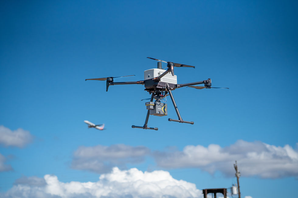
One major factor is the laser scanner itself. High-performance scanners can collect far more measurements per second, allowing operators to capture denser point clouds across large areas. Systems like the YellowScan Surveyor Ultra, for example, can generate extremely dense point clouds while maintaining long-range performance.

Another important component is the navigation system. Every LiDAR point must be accurately positioned in space, which requires a high-quality inertial measurement unit and GNSS receiver working together to determine the sensor’s position and orientation during flight.
Advanced systems such as the RESEPI GEN-II platform from Inertial Labs combine LiDAR scanning with tightly integrated navigation hardware capable of centimeter-level positioning accuracy using RTK or PPK workflows.
Sensors also differ in how many echoes they capture from each laser pulse. In forested environments, the first return may strike the tree canopy, while later returns pass through branches and reach the ground. Sensors capable of capturing multiple returns can reconstruct terrain beneath vegetation far more accurately.
Detection range also plays an important role. Longer-range sensors allow drones to fly higher and cover wider swaths of terrain during each mission, improving overall efficiency when mapping large areas.
Entry-Level LiDAR:
A Starting Point for Many Teams
For organizations beginning their LiDAR workflow, entry-level systems can provide a practical starting point.
One example is the Phoenix LiDAR RECON-XT, a lightweight LiDAR payload designed for mapping smaller sites and construction environments. Systems like this are often used for construction surveys, stockpile measurements, and localized mapping projects where extreme range or ultra-dense point clouds are not required.
Entry-level LiDAR systems allow teams to begin working with aerial point cloud data while maintaining a relatively compact and cost-effective workflow.

Mid-Tier LiDAR Systems for Professional Mapping
As survey teams take on larger or more complex projects, mid-tier LiDAR systems offer improved performance and data density.
The YellowScan Mapper is a good example of this category. Combining a laser scanner with a professional navigation system, it provides strong mapping performance while remaining compact enough for many drone platforms.
The YellowScan Mapper+ expands on this concept by increasing point density and improving vegetation penetration through additional return capability.
These types of sensors are commonly used for corridor mapping, environmental surveys, and topographic mapping projects.
High-End LiDAR Systems for Advanced Surveying
At the high end of the market are LiDAR systems designed specifically for engineering and infrastructure workflows where data quality is critical.
GeoCue’s TrueView LiDAR systems are widely used by professional surveying firms across North America. These sensors integrate LiDAR scanning with high-resolution RGB cameras and tightly coupled GNSS/IMU navigation systems to produce accurate, colorized point clouds.

The systems are typically paired with LP360 processing software, which provides a complete workflow for visualization, QA/QC, classification, and analysis of LiDAR data.
Other high-performance systems, such as those from Inertial Labs and ROCK Robotic, support advanced surveying workflows and specialized mapping missions that require highly accurate positioning and dense point cloud generation.
The Drone Platform Matters More Than Most People Realize
When people research LiDAR workflows, the focus almost always starts with the sensor. But experienced geospatial professionals understand that the drone platform plays an equally important role in the quality of the final dataset.
LiDAR sensors are heavier than typical aerial cameras and often require additional equipment such as GNSS antennas, onboard computing modules, and RGB cameras. These payloads place significant demands on a drone’s power system, flight stability, and payload capacity.
Even small variations in flight stability can introduce noise into a point cloud. For engineering-grade survey data, that level of precision matters.
This is why LiDAR missions rely on aircraft designed specifically for professional payloads and repeatable flight performance.
Inspired Flight platforms were built with these types of missions in mind.
IF800 vs IF1200:
Choosing the Right Platform


Both the IF800 and IF1200 are capable LiDAR platforms, but they are designed for slightly different mission profiles.
The IF800 is a compact professional drone optimized for mapping, inspection, and research missions where efficiency and portability are important. With a payload capacity of approximately 3 kg (6.6 lbs), the aircraft comfortably supports many popular aerial LiDAR systems, including sensors from LiDAR USA, YellowScan, GeoCue, ROCK Robotic, Phoenix LiDAR, and Inertial Labs.
This payload range covers a large portion of the LiDAR market, particularly systems designed for corridor mapping, environmental monitoring, construction surveys, and topographic mapping. Because of its compact form factor and efficient flight performance, the IF800 is often the preferred platform for teams performing routine mapping missions or traveling between multiple job sites.
Most aerial LiDAR payloads integrate several components into a single system, including the laser scanner, GNSS receiver, inertial measurement unit, onboard processing hardware, and often an RGB camera used for colorizing point clouds. When these components are combined into a rugged field-ready sensor, the total payload weight frequently lands somewhere between 5 and 8 pounds, which aligns closely with the IF800’s payload capacity.
The IF1200, on the other hand, is designed as a heavy-lift aircraft for larger sensors and more complex payload configurations. With a payload capacity of up to 8.6 kg (19 lbs), the IF1200 is built to support heavier LiDAR systems and expanded sensor packages that exceed the limits of smaller aircraft.
The increased payload capacity also enables multi-sensor configurations, allowing operators to carry LiDAR alongside additional payloads during the same mission when required.
This capability becomes especially valuable in research and environmental monitoring projects where teams want to capture LiDAR data alongside other environmental measurements.
A Real-World Example:
Multi-Sensor LiDAR Research

During a flood-mitigation research project conducted by California Polytechnic State University, researchers deployed an IF1200 carrying multiple payloads simultaneously, including a YellowScan LiDAR system and additional environmental sensors.
By combining multiple instruments on a single aircraft, the research team collected terrain elevation data alongside environmental measurements during a single mission.
This type of configuration reduces flight time and allows researchers to collect multiple datasets across the same geographic area without flying separate missions.
NDAA-Compliant LiDAR Workflows
Security and supply chain transparency are becoming increasingly important in geospatial operations, particularly for government agencies, utilities, and infrastructure operators responsible for sensitive data collection.
The National Defense Authorization Act (NDAA) restricts the use of certain foreign-manufactured technologies within federal agencies and many critical infrastructure environments. As a result, organizations performing aerial mapping for these sectors must ensure that both their drone platform and sensor systems meet compliance requirements.
Inspired Flight platforms, including the IF800 and IF1200, are designed and manufactured in the United States and meet NDAA compliance requirements. Inspired Flight aircraft are also included on the Blue UAS Cleared List, which verifies cybersecurity and supply chain security standards for government use.
Within the LiDAR ecosystem, some manufacturers have developed sensors specifically intended for secure and regulated environments. GeoCue’s TrueView lineup includes several models designed for these applications, including the TrueView 641, and TrueView 651, which are commonly deployed in government, engineering, and infrastructure mapping workflows where supply chain transparency is important.
Organizations planning LiDAR deployments for regulated environments should always confirm compliance at the specific sensor model level, rather than assuming compliance across an entire product family.
LiDAR Systems Compatible with IF800 and IF1200
Inspired Flight platforms are designed to support an open ecosystem of professional sensors rather than limiting operators to a single integrated payload system. This allows survey teams to select the LiDAR system that best fits their mission requirements, budget, and data quality expectations.
Today, the IF800 and IF1200 support LiDAR systems from several leading manufacturers.
GeoCue TrueView Series - https://geocue.com/drone-lidar/
YellowScan LiDAR Systems - https://www.yellowscan.com
Inertial Labs LiDAR Systems - https://inertiallabs.com
Phoenix LiDAR Systems - https://phoenixlidar.com
ROCK Robotic LiDAR Systems - https://rockrobotic.com
LiDAR USA - https://www.lidarusa.com/
As Inspired Flight continues expanding its LiDAR integrations, additional sensor configurations and standardized mounting kits will continue to simplify aerial LiDAR deployments.
Talk to an Expert
Choosing the right LiDAR system involves more than comparing sensor specifications. Factors such as payload weight, mission type, accuracy requirements, and processing workflows all play an important role in determining the best solution.
Inspired Flight works closely with leading LiDAR manufacturers and geospatial professionals to help organizations select the right drone and sensor combination for their specific applications.
If you're evaluating LiDAR for surveying, inspection, or research missions, our team can help you determine which system best fits your workflow.