
Mapping Water Quality from Above
- Apr 28, 2025
- 4 min read
Updated: Apr 17
In a groundbreaking study conducted in southern Brazil, researchers leveraged UAV technology using the Inspired Flight IF1200 to transform how aquatic ecosystems are monitored, providing real-time, high-accuracy data that traditional methods often struggle to achieve.
The Challenge: Traditional Monitoring Falls Short
Historically, water quality monitoring has relied on satellite imagery and in-situ sampling. However, cloud cover and time gaps often compromise satellite data, making it difficult to obtain real-time insights. Meanwhile, manual sampling is labor-intensive and lacks broad coverage, leading to inefficiencies in data collection. By integrating UAVs into water quality monitoring, researchers discovered a faster, more cost-effective, and precise solution.
The Study: Real-Time Data Collection with UAVs

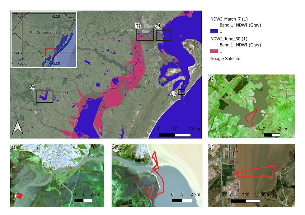
A team of researchers from UFPel, UFRJ, and ONR conducted a study in the São Gonçalo Channel, a vital hydro waterway in Brazil. The goal was to map key water quality parameters such as turbidity and organic matter content using UAVs equipped with hyperspectral sensors.
The study focused on four critical sites:
Water Sluice: A control point for ocean water intrusion.
Port of Pelotas: A key industrial and commercial zone.
Pelotas River Discharge: A major sediment transport area.
SGC Discharge into Patos Lagoon: A crucial estuarine site.
When asked about the motivation behind using UAV technology for water quality monitoring, Felipe Lobo, Adjunct Professor at Universidade Federal de Pelotas, explained:
“The fact that we can access water quality from space without relying on satellite images is a game changer. Using UAVs with appropriate sensors, such as a hyperspectral radiometer, allows us to estimate water quality parameters in near-real-time resolution.”

The Role of UAV Technology in Water Quality Monitoring

At the core of this study was the Inspired Flight IF1200, an NDAA-compliant platform chosen for its reliability and ability to integrate advanced sensing technologies. The UAV carried a suite of state-of-the-art sensors, including:
RedEdge-MX: Captures multispectral imagery for vegetation and water analysis.
OceanOptics USB-650: Measures spectral reflectance, crucial for water quality assessments.
DLS2 (Downwelling Light Sensor): Ensures irradiance correction for enhanced accuracy.
Operating at altitudes between 50 and 80 meters, the IF1200 collected real-time spectral data, which was compared against Sentinel-2 satellite imagery and in-situ radiometer measurement, confirming its accuracy and reliability.
Advanced-Data Processing with UAV Technology
To maximize accuracy, researchers implemented a step-by-step data processing workflow, ensuring consistency across UAV and satellite data sources.
The data gathered by the UAV was processed using DroneWQ, a specialized Python-based package for aquatic remote sensing. The workflow included:
Sun-Glint Removal: Using the Hedley Method to enhance water surface clarity.
Atmospheric Correction: Implemented via ACOLITE for optimal spectral accuracy.
Algorithmic Analysis:
Turbidity Assessment (Dogliotti et al., 2015)
CDOM Estimation (Colored Dissolved Organic Matter)
Cross-Validation: Results were validated against Sentinel-2 data and in-situ measurements, achieving a Mean Absolute Percentage Error (MAPE) of just 15%, a significant leap forward in monitoring accuracy.

Real-World Applications of UAVs in Water Quality Monitoring

The impact of this research extends far beyond the study itself. UAV technology is enabling smarter, more efficient environmental monitoring with applications that include:
Environmental Conservation: Identifying pollution sources in real-time to support cleanup and conservation efforts.
Industrial Monitoring: Ensuring compliance with environmental regulations in ports and industrial sites.
Disaster Response: Rapid assessment of water contamination following floods, oil spills, or other ecological disasters.
Policy & Regulation: Governments can leverage this UAV-based approach for data-driven decision-making in water management and dredging operations.
Setting a New Standard in Aerial Water Monitoring

By combining UAV technology with advanced sensor integration and AI-driven data processing, this study highlights the potential of UAVs in next-generation environmental monitoring. The IF1200 has demonstrated its ability to deliver near real-time, high-accuracy assessments that traditional methods struggle to achieve.
When asked about the most impactful real-world application of this research, Felipe Lobo, shared his perspective:
“Hyperspectral data from UAVs allows for a deep investigation of water components. In the near future, proper water quality management will depend on more precise algorithms, and the current approach enables such investigation.”
As the demand for precise, scalable water quality monitoring solutions grows, UAVs are proving to be an invaluable tool in scientific research, industrial applications, and policy-driven environmental initiatives. This study serves as a compelling example of how UAV technology is reshaping the future of water monitoring, providing researchers, industries, and policymakers with the tools they need to see, understand, and protect our waterways like never before.
Acknowledgments
This study was made possible through the collaboration and expertise of researchers from UFPel, UFRJ, ONR, and FURG. Special thanks to Felipe Lobo, Lino Sander de Carvalho, Leonardo Pereira, Wesley Moses, Gilberto Collares, and Fernanda Giannini for their contributions to data collection, analysis, and project execution.
Glossary
In-situ: Measurements taken directly in the environment rather than from remote sensing.
Turbidity: The cloudiness or haziness of a fluid due to suspended particles.
Hyperspectral: A type of imaging capturing a wide spectrum of light to identify specific materials.
Sluice: A water channel controlled by a gate to regulate flow.
Hedley Method: A technique for removing sun-glint effects from water-based remote sensing images.
ACOLITE: An atmospheric correction tool used for remote sensing imagery over water.
Sentinel-2: A European Space Agency satellite providing high-resolution optical imagery.
UFPel: Universidade Federal de Pelotas, a research institution in Brazil.
UFRJ: Universidade Federal do Rio de Janeiro, a leading university in Brazil.
ONR: Office of Naval Research, supporting scientific research for naval applications.
ALM: A research organization involved in environmental monitoring.
HyperSAS: A radiometric sensor used for water quality assessments.
Inspired Flight: A UAV manufacturer specializing in NDAA-compliant drone technology.


